

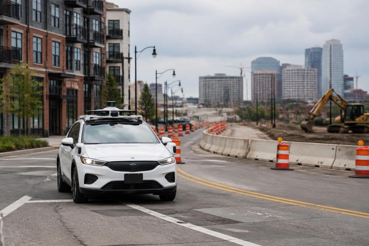
An autonomous vehicle can use cameras, radar, LiDAR, GPS, and onboard software to find its way without a prebuilt high-definition map. The harder question is whether it can do that safely when road markings fade, lanes change, or construction moves traffic into a new path.
- Cameras read lane lines, signs, lights, and nearby vehicles.
- LiDAR measures the shape and distance of objects around the vehicle.
- A live map can change faster than a stored road survey.
What a high-definition map gives the vehicle
A high-definition map stores road details that ordinary navigation maps leave out. It can show lane boundaries, road edges, traffic signs, stop lines, turns, and the position of fixed objects such as poles or barriers.
That information gives the vehicle a prepared view of the road. The vehicle still needs sensors to check what is happening now, but the map can tell its software where a lane should be and where a turn begins.
Without that stored detail, the vehicle must estimate more from sensor data. A camera may see a lane line, while LiDAR measures the curb and radar tracks moving objects. The software then builds a temporary view of the road and uses it to choose a path.
This approach is often called map-light or map-free driving. The name can mislead. A vehicle still needs some form of map or location model for many trips, even if that map is built during the drive instead of loaded before departure.
How the vehicle can build a live view
The vehicle compares new sensor readings with earlier readings as it moves. A method called simultaneous localization and mapping, or SLAM, helps estimate the vehicle’s position while building a map of nearby surfaces and objects.
That local map can help with roads that have changed since the last survey. A temporary barrier, a closed lane, or a new work zone may appear in the sensor data even when an old stored map still shows the original road layout.
The vehicle also needs lane and road-edge detection. Cameras can read painted markings and traffic signs. LiDAR can trace curbs and barriers when paint is hard to see. Radar can measure the movement of other vehicles in poor visibility, though it gives less detail about the shape of objects.
The work is shared between sensors. No single sensor supplies a full view in every condition.
A missing map puts more weight on the sensors and the software that reads them. Robot24 can point you to reports on road tests, named vehicles, and stated limits before the next section looks at where map-free driving gets difficult.
Where map-free driving gets difficult
A road can change in ways that a sensor must interpret correctly. Fresh paint may cover an old lane line. A police officer may direct traffic by hand. A delivery truck may block a sign, or a work zone may leave several possible paths through a narrow lane.
Weather adds another problem. Rain can hide markings and affect cameras. Snow can cover road edges. Dust or spray can reduce the useful range of LiDAR. A sensor system may still see objects, but its picture of the lane can become less certain.
Location also matters. GPS can place a vehicle near the right road while failing to show which lane it occupies. Tall buildings, trees, tunnels, and poor satellite coverage can make that estimate less steady.
I would not choose a map-free system for broad public use until its handling of these cases is shown with clear road evidence.
What the map still does well
Stored maps remain useful when the road itself is stable. They can give the vehicle a known lane layout before sensors detect every marking, which may help it plan an exit, position for a turn, or understand a complex junction.
They also reduce the amount of road detail the vehicle must work out from scratch. That can lower the load on onboard computers and make the driving task easier to test in a fixed area.
The tradeoff is maintenance. A stored map can become wrong after resurfacing, construction, a new traffic signal, or a changed speed limit. Map-free systems avoid some update work, but they place more pressure on sensing, software, and safety checks during every trip.
A practical decision guide
Before judging a vehicle that claims to work without high-definition maps, check:
- Road area: Is the system limited to mapped routes, or can it handle unfamiliar roads?
- Sensor mix: Does it use cameras alone, or combine cameras with LiDAR and radar?
- Change handling: What does it do when lane markings, signs, or barriers move?
- Fallback plan: Can it slow down, stop safely, or ask for remote help?
- Evidence: Do demonstrations include rain, road works, poor markings, and blocked signs?
- Map role: Does the system avoid maps, or use a lower-detail map with live sensor updates?
The practical answer is narrow. Autonomous vehicles can work with less map detail when their sensors and software can build a reliable local view, but every missing map feature becomes another job for the vehicle to solve in traffic. The open question is how often that local view stays correct when ordinary roads stop looking ordinary.
